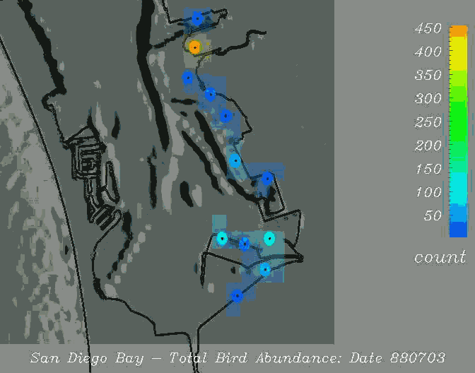
Plate 1. Bird abundance in South San Diego Bay. This image typifies the field survey and map data collected in San Diego Bay. This figure depicts discrete empirical observations as opaque circles joined by translucent squares resulting from nearest-neighbor interpolation. T. Todd Elvins and J. Helly at SDSC produced image as part of the San Diego Bay Project using IBM Data Explorer. Data provided by U. S. Navy and the Unified Port District of San Diego; funded by the San Diego Bay Interagency Water Quality Panel.
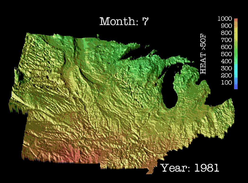
Plate 2. Mean monthly incident solar radiation data collected at the county level of spatial distribution in the Midwest Corn Belt. This is one image from a time-series developed for an animation covering twenty years at monthly time steps. Stuart Gage of Michigan State University, J. Helly and T. Elvins at SDSC produced it.
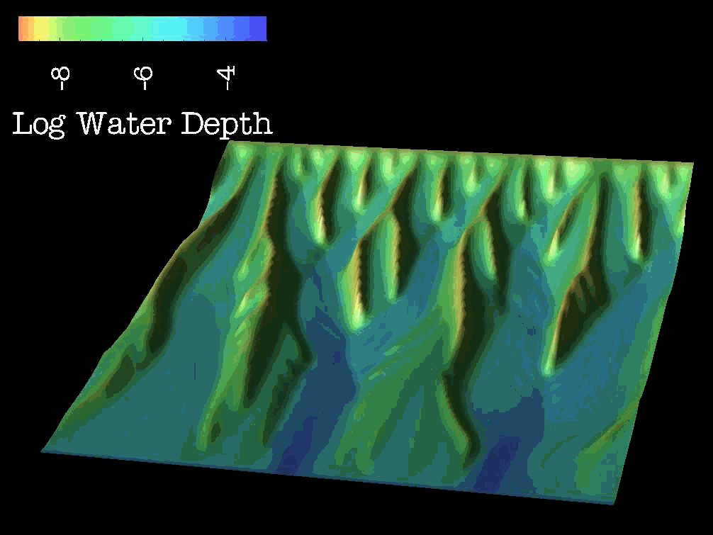
Plate 3. Landscape erosion produced from computer model output. This is one frame from a 312-frame animation used to display the output of a mathematical model describing surface water runoff and associated landscape erosion of a hypothetical ridge. The model was developed by T. Smith and G. Merchant at the University of California, Santa Barbara and the image was produced by J. Helly, T. Elvins and N. Kelly at SDSC.
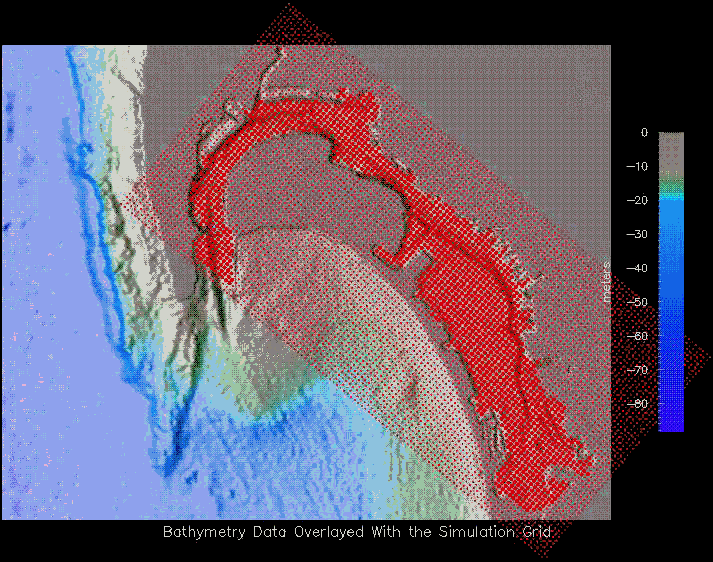
Plate 4. Regular, rectangular grid developed to describe the interior of San Diego Bay for use in hydrodynamic modeling. Image produced by R. Marciano at SDSC.
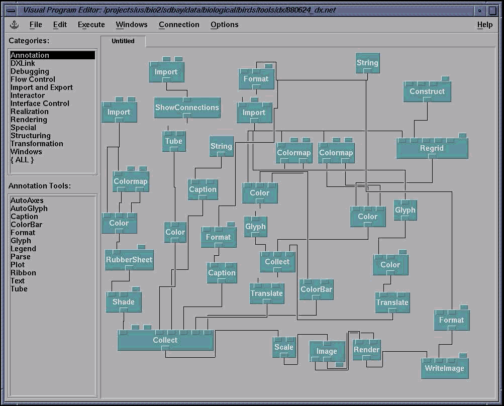
Plate 5. Processing Network for Bird Abundance Data Using IBM Data Explorer (developed by T. Elvins / SDSC).

Plate 6. 12 months' solar radiation data depicting seasonality.